Nor’easter weekend for NJ: Major flooding, 60+ mph winds batter Shore
The Bottom Line
The coastal storm rages on. And this is an increasingly nasty one.
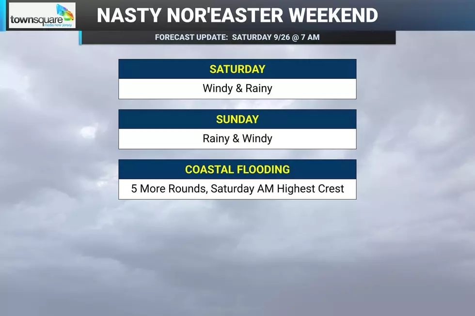
So far, our nor'easter has been delivering some truly miserable, inclement weather: wind-driven rain, damaging wind gusts, significant coastal flooding, and an angry ocean. And there's more to come. While the Jersey Shore is taking the brunt of the storm, every corner of New Jersey will feel impacts through the rest of the weekend. The big concern Saturday morning is wind and coastal flooding. A top gust of 69 mph was recorded overnight on Long Beach Island. This will be the highest tide crest of the storm, with major category flooding possible.
We might catch a bit of a lull Saturday afternoon and evening, as rain bands fade and wind speeds dial back. But rain and wind will intensify again Saturday night into Sunday morning, as the center of this storm system approaches. Sunday morning-midday will likely be the wettest period of the weekend.
The nor'easter will finally loosen its grip on New Jersey Monday. Lingering showers may hang around through midday before drier weather takes over.
Tons of events have been cancelled around New Jersey due to the nasty weather. Hopefully you have a dry, warm, safe place to ride out the storm.
Some first weekend of fall, huh?!

Coastal Flooding
This is still my No. 1 concern with this storm. And Saturday morning's high tide is the biggest of the bunch.
Oceanfront high tide occurs around the 8 a.m. hour Saturday, with back bays and tidal waterways cresting two to three hours later (so, late morning). Water levels are expected to reach moderate to major flood stage up and down the Jersey Shore.
That is serious. Expect widespread water inundation in vulnerable coastal communities, numerous flooded or impassable roads, and the potential for property damage.
We've had several days of on-shore winds stockpiling water in back bays and tidal waterways. An elevated astronomical tide due to Saturday's full moon adds another ingredient to an already problematic setup. That's why tidal guidance is showing estimates a couple inches above "major" flood stage for most Shore points. Our one saving grace might be the wind direction. As of early Saturday morning, the strong gusts are coming from the north in many spots — that is not a direct on-shore wind. So hopefully that will keep those floodwaters a few inches lower than forecast. Fingers crossed, as we hold our collective breath.
Unfortunately, Saturday morning is not the last high tide we have to worry about.
Four more troublesome tidal cycles remain:
—Saturday evening... Moderate flooding
—Sunday morning... Moderate flooding
—Sunday evening... Minor flooding
—Monday morning... Minor flooding
Coastal Flood Warnings and Coastal Flood Advisories remain posted for New Jersey's tidal waterways, with the exact headline and expiration time varying by location. Those alerts currently last through Sunday.
Please take flooded roads seriously. Never attempt to drive, walk or swim through floodwaters. Salt water is corrosive, flood depth can be deceptive, and just because a road was passable during one tide does not mean it will be during the next one.
Wind
Saturday is the big wind day.
A High Wind Warning is in effect for the Jersey Shore until 6 a.m. Sunday, calling for regular gusts of 60+ mph.
As I mentioned above, we have already seen a gust to 69 mph at Harvey Cedars on Long Beach Island early Saturday morning.
For most of inland New Jersey, a Wind Advisory continues until 6 a.m. Sunday, with gusts generally reaching 40+ mph. Even those lower inland wind speeds will be enough to toss around unsecured outdoor objects, make driving difficult for high-profile vehicles, snap tree branches, and cause scattered power outages.
Calmer winds will prevail (somewhat) through Saturday afternoon and evening, although it's going to stay windy (if not gusty) through Saturday night.
Sunday should still be windy, but not quite as ferocious. Gusts will gradually ease as the day goes on, followed by a much more noticeable calming trend Sunday night.
Rain
New Jersey is in for a thoroughly soggy weekend, although it will not rain nonstop.
Bands of wind-driven rain will are pushing through the state Saturday morning. That will continue for a while.
There may be a lull Saturday afternoon into early evening, with rain becoming lighter and more widely scattered for a time.
Then the atmosphere reloads Saturday night.
Rain will fill back in and become steadier and heavier through Sunday morning. Periods of rain continue Sunday, heavy at times, before another possible drying trend later in the day. That's where we could pick up multiple inches of rain, especially along coastal areas.
By the end of the weekend, total rainfall should generally reach:
—1 to 2 inches across western New Jersey.
—2 to 4+ inches across eastern New Jersey.
Because that rain is falling over an extended 48 hour time frame, the threat of widespread flash flooding and river flooding is somewhat limited. Having said that, there could be some big puddles, ponding, and localized flooding issues to watch out for. Especially during and after heavy downpours. And where heavy rain aggravates tidal flooding near the coast.
A few rumbles of thunder are possible too, although widespread thunderstorms and severe are not a primary concern here.
Rough Surf
The ocean is angry. And has been all week.
A High Surf Advisory remains in effect until 8 p.m. Sunday, with 6 to 12 foot waves continuing to batter New Jersey's beaches.
A high risk of dangerous rip currents also continues through Sunday evening.
This is absolutely not swimming weather. Stay out of the ocean.
The repeated pounding from large waves and elevated water levels will also continue eating away at beaches. Significant beach erosion is likely here — I really hope our dune system survives the storm, as we'll need that desperately for future coastal storms this winter.
By the way, just offshore, conditions are even more extreme. Seas will run as high as 15 to 20 feet during the height of the storm Saturday.
Even after the rain stops and the wind settles down, it will take some time for the ocean to fully calm down.
Looking Ahead
On the other side of this storm, there is finally some legitimately good weather news ahead for the closing days of September.
Monday will be a transition day. Lingering showers may continue through about midday as the nor'easter slowly pulls away. Skies will remain mostly cloudy. And temperatures will stay on the cool side with highs in the lower 60s.
Conditions improve dramatically by Tuesday.
Tuesday looks partly sunny, calm and completely dry, with high temperatures rebounding to around 70 degrees.
It will get even warmer than that later in the week, potentially flirting with 80+ degrees.
So yes, this weekend is a windy washout. Weather and surf conditions will be downright nasty at times..
We'll be on-air and online with the very latest until the final raindrop falls, the final wind gusts, and the final wave crests. Be safe out there, New Jersey..
The best NJ foods and soups for a nor'easter weekend
Gallery Credit: Mike Brant
Dan Zarrow is Chief Meteorologist for Townsquare Media New Jersey. Follow him on Facebook for the latest forecast and realtime weather updates.
Remembering Superstorm Sandy: 14 years later
Gallery Credit: Dan Zarrow
