
NJ weather: From 80s to 50s, wet weather returns this weekend
The Bottom Line
We have been on quite a temperature roller coaster this week, with most (but not all) of New Jersey alternating between summerlike warmth and cooler marine air.
Thursday will be another unseasonably warm day, with temperatures more typical of June than early May. But I am struggling to call it truly "summerlike," since the morning is cool, humidity levels will be manageable, and rain/thunderstorm chances are practically zero. It is exceptionally rare for New Jersey to get this combination — so soak it in, and enjoy it!
A cooldown will kick in Friday, although we will squeeze out one more dry weather day.
The first weekend of May unfortunately turns even cooler and cloudier, with rain chances added to the mix too. While showers look hit-or-miss at best on Saturday, Sunday looks wet and pretty miserable.

Thursday
A comfortably cool start, with morning temperatures in the 50s. A warm finish, with afternoon temperatures mainly in the 80s. Cooler to the north (70s) and along the immediate coast (60s).
It is going to be a very warm and very nice day across New Jersey. We will see solid sunshine, with passing clouds. And it will stay completely dry, from start to finish.
I have increased our wind speed forecast, to the "breezy category" by late afternoon. Nothing too fierce — just strong enough of a breeze to keep the warm air moving around.
Record high temperatures for this date are 92 at Newark, 88 at Trenton, and 91 at Atlantic City. Those records are probably safe — my forecast puts highs between 80 and 85 degrees for most of the state.
Things stay quiet Thursday night, even though a cold front will pass across New Jersey. It will be rain-free.
Under partly cloudy skies, overnight low temperatures will dip into the 50s. That has been status quo so far this week.
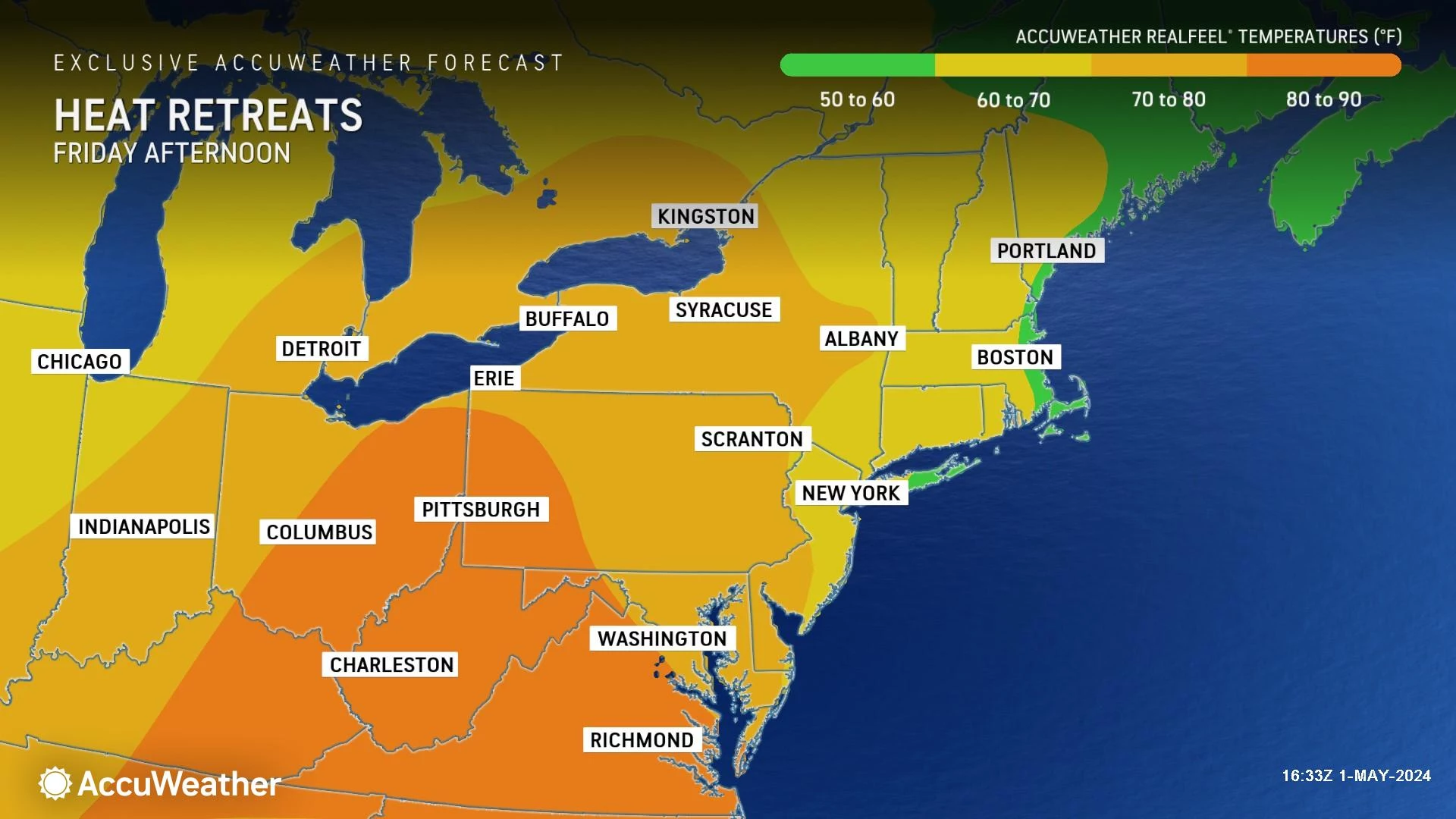
Friday
Turning much cooler. No more 80s. Not even 70s. High temperatures on Friday will only reach about 60 to 65 degrees — a full 15 to 20 degrees cooler than Thursday.
Having said that, it will not be an awful weather day. Especially since we stay rain-free once again. Clouds will increase, as sky cover progresses from partly to mostly cloudy.
Saturday
Not a great day. But there is a chance most of New Jersey stays dry for yet another day.
Saturday will be mostly cloudy to overcast. And high temperatures will only make it to around 60 degrees — that is, 50s north/coast and 60s inland.
The best chance for spotty rain showers will come as a storm system clips northwestern New Jersey Saturday afternoon. We will have to see just how far south those raindrops are able to drift. Nothing heavy or steady, just some hit or miss showers. Rainfall totals will only be a few hundredths of an inch.
Sunday
Sunday's forecast is my least favorite of the week. We will be socked in by cloud cover. With a stiff, damp on-shore breeze. High temperatures will get stuck in the 50s. (Maybe 60 degrees in inland South Jersey.)
And then there's the rain. Periods of rain appear likely throughout the day Sunday, from early morning through late evening. I am not saying it's going to rain all day — a.k.a. a "total washout". But it does look wet and dismal and miserably cool, overall.
There is very little concern for severe weather or even thunderstorms — the cooler, drier air mass will limit any big dynamics from setting up. But we could see up to an inch of rain by Sunday night. Not quite enough to cause widespread flooding, but there could be some ponding issues in low-lying areas and roadways.
Monday & Beyond
Proving Mother Nature has a twisted sense of humor, warm air returns just in time for the new workweek. High temps will return to the 70s on Monday and Tuesday, possibly bumping into the 80s again by midweek.
There will be some unsettled weather along the way next week, with a daily chance of showers and thunderstorms. Models are all over the place in terms of timing, so I do not want to get too specific right now. Nothing steady, although there could be some stronger storm cells and localized downpours along the way. A symptom of our increasingly warm and humid atmosphere this time of year.
LOOK: Here are the 25 best places to live in New Jersey
Dan Zarrow is Chief Meteorologist for Townsquare Media New Jersey. Follow him on Facebook for the latest forecast and realtime weather updates.
LOOK: Books set in New Jersey
Gallery Credit: Stacker